
Common Grounds

Every oil & gas lease,
pre-assessed for solar.

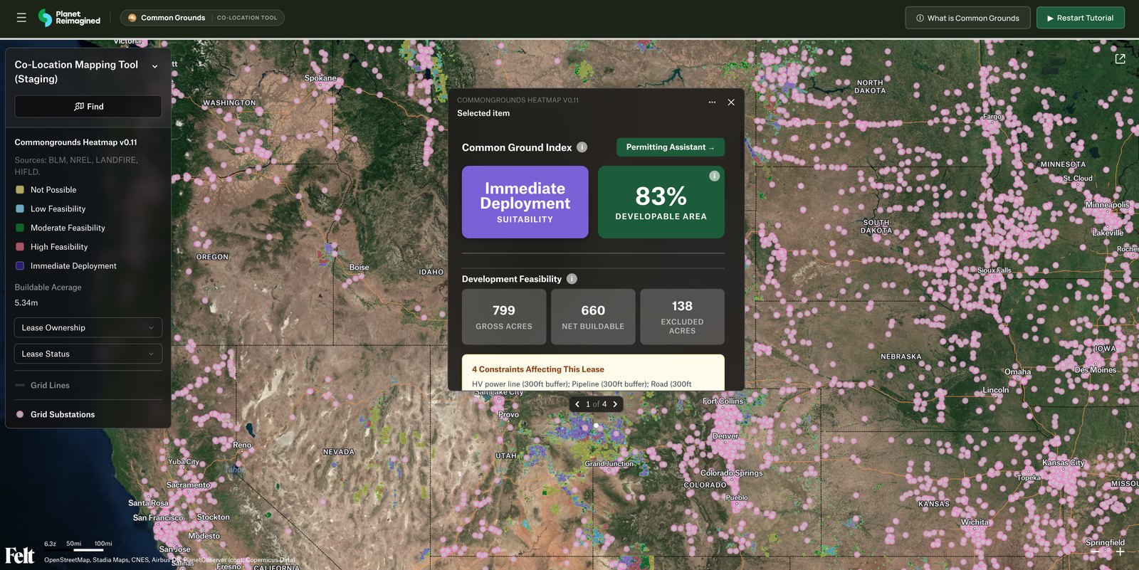
The full context behind each lease — geospatial, environmental, financial, and regulatory — assembled into one co-location pre-assessment. What took weeks of cross-referencing now takes minutes.
Oil & gas leases Solar-ready land
Common Grounds co-location tool — lease detail showing Common Ground Index, developable acreage, and constraints
01 For who
Clean Energy Developers
Site selection
Land & Lease Teams
Acquisition & diligence
Oil & Gas Operators
Putting acreage to work
Communities & Policymakers
Local approval
02 What every parcel tells you
D1
Common Ground Index
Composite suitability score
D2
Development Feasibility
Acres · slope · MW · transmission
D3
Environmental Data
Species · grazing · constraints
D4
Grid Economics
LMP pricing & ELCC value
D5
Permitting Path
County ordinance score 1–5
03 How it works — in motion Auto-playing
01 Different datasets, stipulations & permit docs arrive as map layers
AEvery data type becomes a layer
Common Ground Index
D O&G LEASES D TERRAIN & SOLAR S ENVIRONMENT D TRANSMISSION P PERMITTING
AIncoming data → layers
O&G lease parcelsDataset
Terrain & solar resourceDataset
Environmental constraintsStipulation
Transmission & gridDataset
County permitting rulesPermit doc
Geospatial, financial, environmental, and regulatory sources each land as their own map layer.
PPermitting layerPermit doc
Permitting score 3/5
Moderate · conditional use in Carbon County, WY
Permitting Assistant Online
Can I build utility-scale solar on this lease?
Yes — it’s a conditional use here. Plan for a 50-ft setback and a county hearing. ⚖ Score 3/5 · Moderate ▸ Zoning Ordinance §7
What about the creek crossing the parcel?
A riparian buffer applies along the creek — that strip is already excluded from the buildable acres in the terrain layer. ▸ Hydrography layer
Ask about setbacks, zoning, hearings…
Common Ground Index
Immediate Deployment
Suitability
0.87
Composite score
Lease, terrain, solar, environment, transmission, and permitting — every layer combined into one score for the parcel.
04 Where the data comes from

Common Grounds consolidates everything a co-location decision needs — from geospatial and environmental records to financial information and infrastructure maps — into one resource. Click a card to see the datasets behind each layer of the Common Ground Index.

Consolidated
Every dataset, one map
Pre-assessment
Minutes, not weeks
Parcel-level
Scored lease by lease
Co-location
Less land, less paperwork
Common Grounds · A Planet Reimagined initiative
Open the Co-Location Tool →